Garmin esindus Eestis - tule liitu klubiga.
Maksa hiljem 3 osas - 0€ sissemakse, 0€ lisatasu
Toode on arhiivis, kuvatakse vaid informatiivsel eesmärgil.
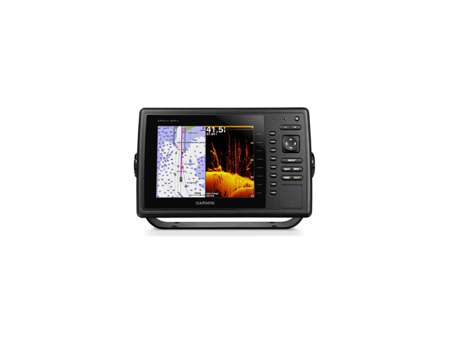
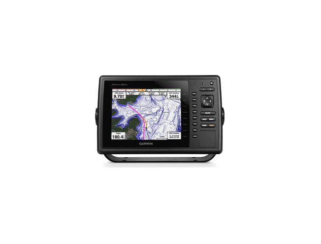
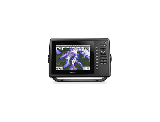
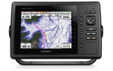
toetab LakeVü™ HD Ultra kaarte ja BlueChart® g2 ning BlueChart g2 Vision® kaarte
NMEA 2000® võimaldab autopiloodi ühendamise, mootori parameetrite kuvamise, SiriusXM® Weather ilmajaama ja muude andurite ühendamise. GPSMAP 820 loeb detailseid kaarte LakeVü HD Ultra, BlueChart g2 ja BlueChart g2 Vision. Lisaks ühtib kõikide Garmini mereradaritega.
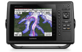
Funktsionaalsust lisab juhtmevaba side nt. Apple®seadmetega
BlueChart® Mobile. Plotteril on kaks SD™ kaardi mälupesa, mis võimaldab suurendada säiltvaid andmeid mitmete gigabaitideni. Ekraani saab paigaldada tasasele pinnale (uputada) või kinnitada kronsteinile.
Võrguühendus tagab GPSMAP 820xs kasutamise koos muu varustusega (radar, skanneeriv kajalood GCV 10 DownVü / SideVü, lisakaardid ja POI'd).
Layline, tuule roos, tõesed ja näivad kursid ja tuulesuunad.


Physical & Performance | |
| Physical dimensions | 29.3 x 18.8 x 7.4 cm |
| Display size, WxH | 16.2 x 12.1 cm, 20.3 cm diagonal |
| Display resolution, WxH | 800 x 600 pixels |
| Display type | SVGA display |
| Weight | 1.6 kg |
| Water rating | IPX7 |
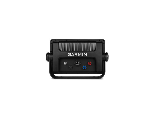
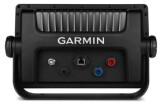
| Antenna | Internal with external connection |
| NMEA 2000® compatible | yes |
| NMEA 0183 compatible | yes |
| SiriusXM™ Weather & Radio compatible | yes |
| Power consumption | Max power usage at 10 Vdc: 14 W Typical current draw at 12 Vdc: 1.1 A Max current draw at 12 Vdc: 3.2 A |
| Mounting options | Bail, flat or flush |
| Garmin Marine Network™ ports | 1 |
Maps & Memory | |
| Preloaded maps | None |
| Accepts data cards | 2 SD™ cards |
| Waypoints | 5,000 |
| Routes | 100 |
| Track log | 50,000 points; 50 saved tracks |
Chartplotter Features | |
| Garmin Radar compatible | yes |
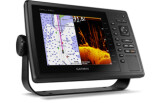
| Garmin Sonar compatible | Yes (built-in) and GCV™ black box compatible |
| Supports AIS (tracks target ships position) | yes |
| Supports DSC (displays position data from DSC-capable VHF radio) | yes |
| Tide tables | yes |
| Garmin Meteor Audio System compatible | yes |
| Supports Fusion-Link compatible marine radios | yes |
| GCV™ Black Box sonar support | yes |
| BlueChart® Mobile (planning) compatible | yes |
| Garmin Helm compatible | yes |
Sonar Features & Specifications | |
| Dual-frequency (50/200 kHz) sonar capable | yes |
| Dual-beam (77/200 kHz) sonar capable | yes |
| Frequencies supported | 50/77/200 kHz, CHIRP (low, medium, high), DownVü |
| Transmit power | 1 kW traditional; 1 kW single channel CHIRP |
| CHIRP sonar technology | Yes (Built-in) |
| DownVü™ | Yes with CHIRP (built-in) |
| SideVü™ | Yes (with GCV™ black box, sold separately) |
| Maximum depth | 1,750 ft @ 50 kHz, saltwater, Garmin dual freq transducer @ 500 W 2,700 ft @ 50 kHz, saltwater, Airmar B260 transducer @ 1000 W (depth capacity is dependent on water bottom type and other water conditions) |
| Bottom lock (shows return from the bottom up) | yes |
| Water temperature log and graph | yes |
| Sonar recording | yes |
| Sonar history rewind | yes |
Connections | |
| NMEA 0183 input ports | 2 |
| NMEA 0183 output ports | 2 |
| Video input ports | None |
| Video output ports | None |
| Wireless connectivity | yes |


Kevad kampaania
Kas oled kevadeks valmis?
Meil on Sulle pakkuda menukad mudelid
väga hea hinnaga.
